
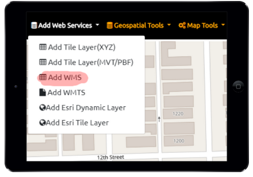
OGC WMS – Web Map Service URL is supported. You can add URL via menu or you can add via our JSON config file that let’s you add additional layers and data from that WMS. WMS delivers PNG image for the bounding box in your view. As you pan or zoom out the software is requesting another image (getmap request) this is opposed to a gettile request from a WMTS.
However, many WMS are powered by cache of tiles with geowebcache or other means to speed up their performance.