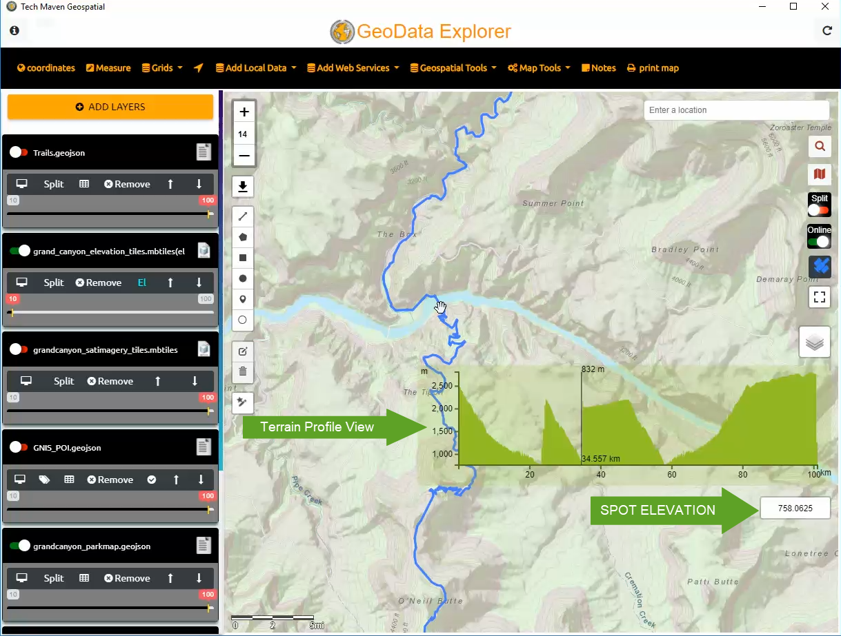
Spot Elevation for your location or cursor location and Terrain Profile View

come from Online Tiles or Offline mbtiles.  We support MapZen’s Terrarium PNG format where elevation has been encoded in the RGB of the image. We have tools to convert elevation data into this format as well as use MapZen’s produced data.


Translate »

By continuing to use the site, you agree to the use of cookies. more information

The cookie settings on this website are set to "allow cookies" to give you the best browsing experience possible. If you continue to use this website without changing your cookie settings or you click "Accept" below then you are consenting to this.

Close