
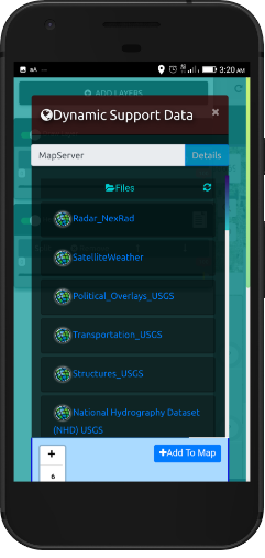
Support Offline/ Disconnected Data
GEOINT DATA EXPLORER is all about the data formats it supports and it’s in app vector tiling engine and OSM vector tiles with custom styles included
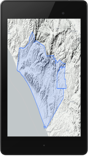
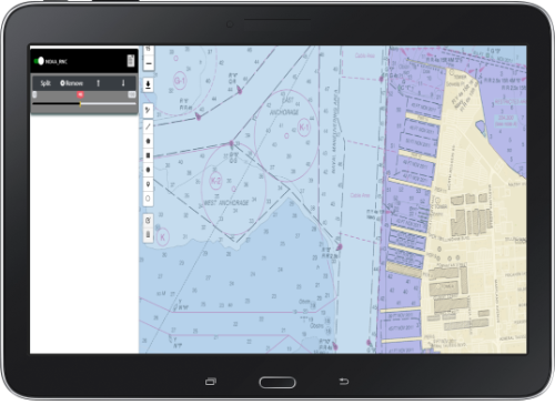
OGC GeoPackage Raster Tiles and Vector Features.
MBTILES, SHP, GeoJSON, KML, CSV – list of supported formats
Rapid Data Visualization
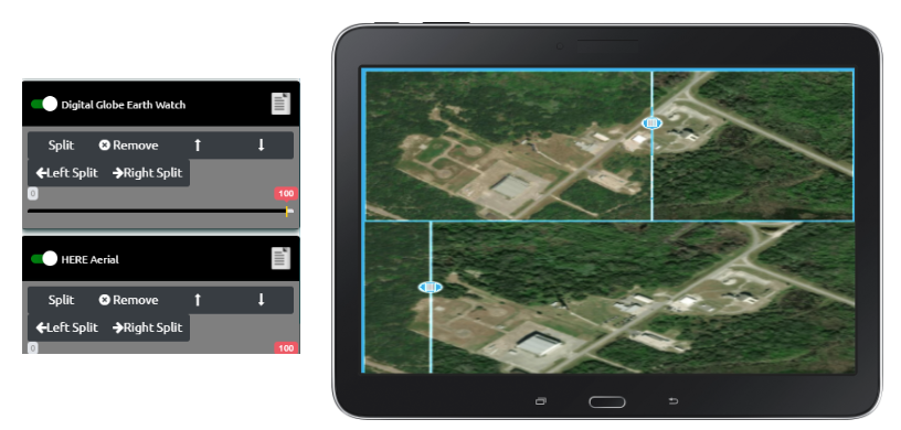
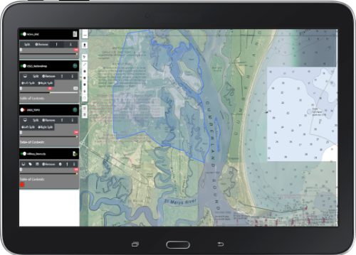
The app supports rapidly loading offline and online data and mashing up data and controlling layer order, opacity/transparency as well as adding raster basemaps
Powerful Data Mangement
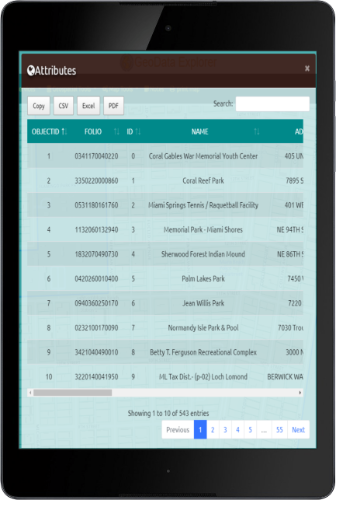
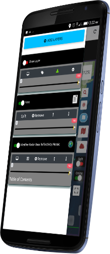
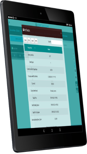
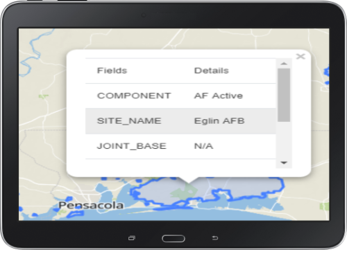
View Attribute Table and Control Popups and Labels
Map Tools and Analysis
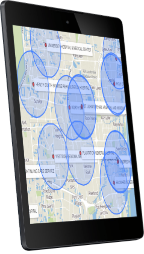
Perform in app analysis like buffer, envelop, center, convex, voronoi or calculate or search for a Bounding Box(BBOX).
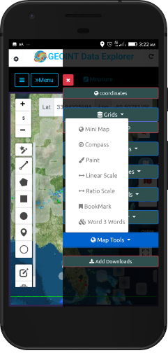
Toggle on Map Tools that you may need like scale bar, map scale, overview mini map, Spatial Bookmarks, Paint tools and others
Toggle On/Off Map Features
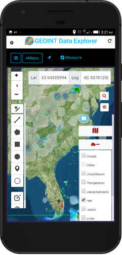
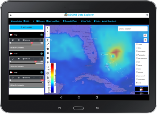
Weather Overlays
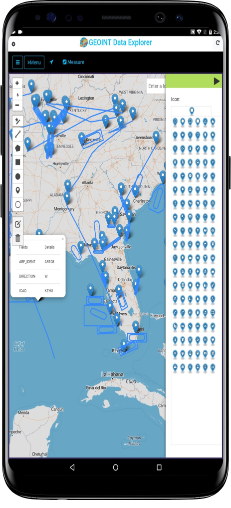
View Attribute Table
Display GRIDS
Quickly Mashup Data
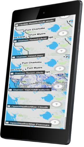
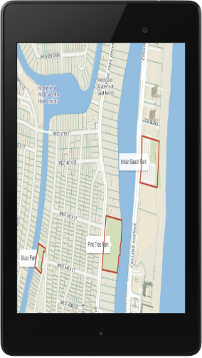
Map Overlays
Best Tool for Analysis and management of data
The map has powerful data management and build in tools for analysis and display and management of data.
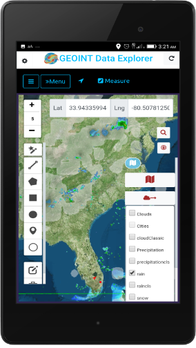
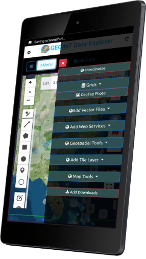
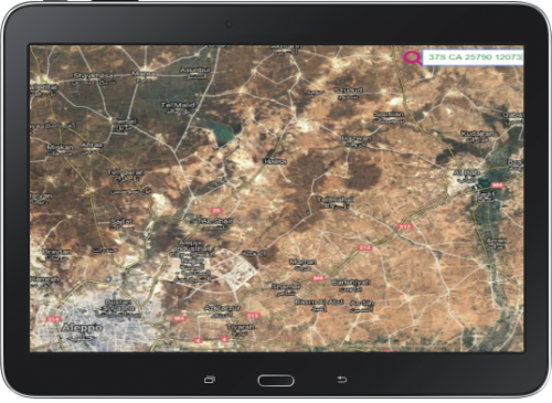
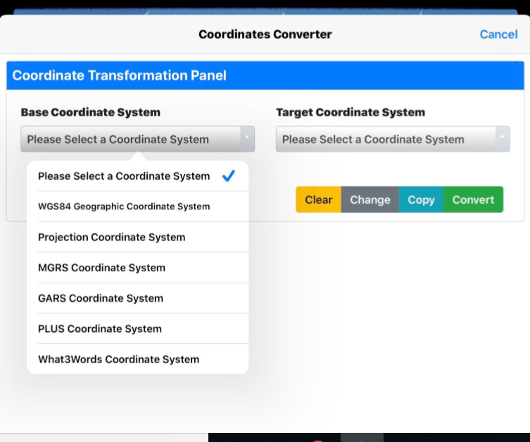
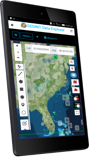
Show GPS Coordinates
Show GPS Coordinates in 3 Forms: ddd.ddddd / ddd mm.mmm / ddd mm ss.s
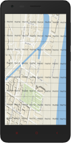
MGRS – Military Grid Reference System and others | Geolocation settings
View Attribute Table

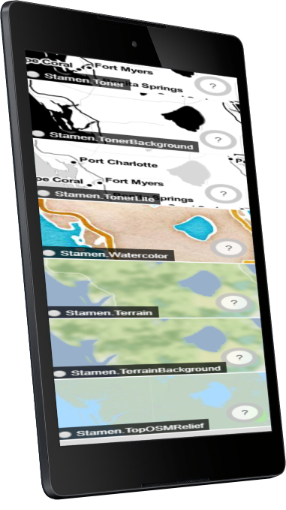
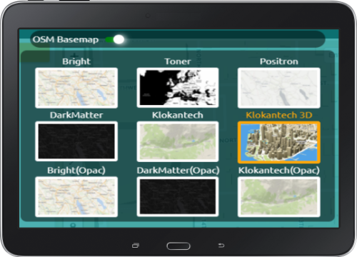
Raster Tile Basemap Picker
Vector Tile Open Street Map Styles Picker
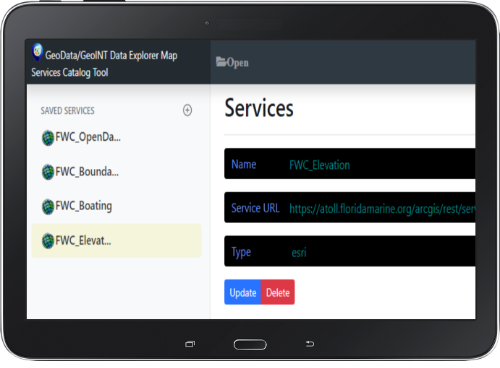
Internet Mapping Services
Users can load their own Weather data and any Basemap they want via the Add Internet Mapping Services via their URL.
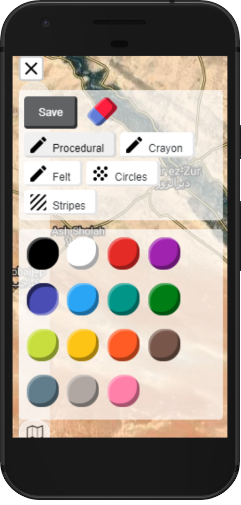
Quickly Annotate and Paint
MapTools – Mini Map, Compass, Paint, Linear Scale, Ratio Scale, Spatial Bookmarks,What3Words.
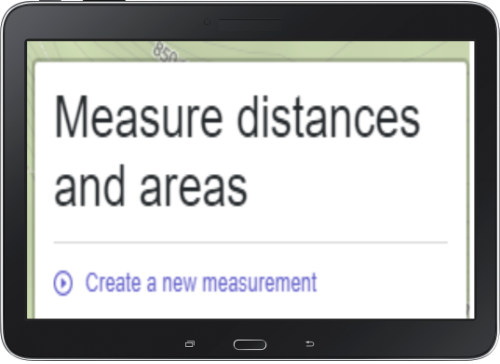
Measure Tool
Measure linear and area.
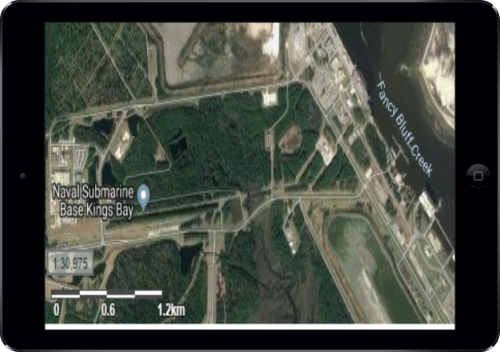
Map Scale
Both a scale bar in Metric (M or KM) and traditional Map Scale 1:500,000 or 1:50,000 is included as to optionally toggle on.
Map Overlays
Enable the Table of Contents Mode (by default enabled on Landscape mode in Portrait mode click the hamburger menu icon).
Search
Search uses Google Maps API/Places and enables Geocoding Addresses or Place Searches. In Address Mode( Google) Requires Internet.
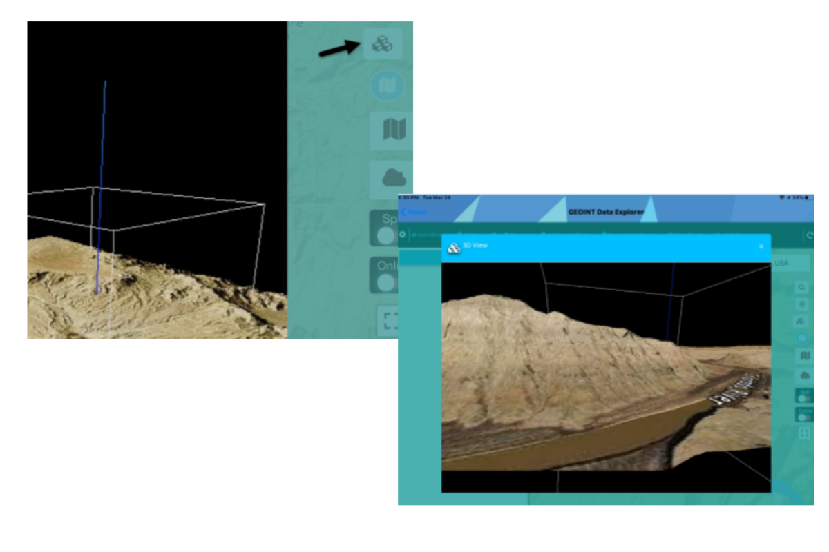
MAP TOOLS
MapTools – Mini Map, Compass, Paint, Linear Scale, Ratio Scale, Spatial Bookmarks,What3Words.
Adjust Opacity/Transparency
You can easily adjust opacity /transparency .
Geospatial Tools
- Buffer
- voronoi
- Center
- Envelop
- convex
- BBOX – Bounding Box
- BBOX Polygon
Add mouse over labels or permanent Labels
You can add mouse over labels or permanent Labels.
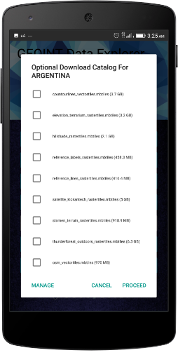
Download Optional Offline Data
Downloaded data to the Map – Click Local Downloads and Add Downloads if in Portrait mode or Landscape it’s Upper Left Menu Item.
Select each file you want to load.In future releases we will have load all button.
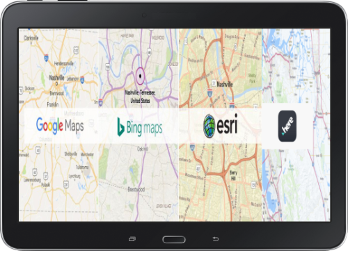
Quickly add premium basemaps and satellite imagery from multiple providers

Multi-INT Data Fusion
Imagery Exploitation
Calculate BBOX
COP - Common Operating Picture
Data Creation and Editing
Who are the users of the App?
The US Intelligence CommunityUS State Department, US Department of Homeland Security, FEMA – Federal Emergency Management Agency, US Coast Guard, US Border Protection, Foreign Militaries (NATO Countries) with GeoAXis Credentials