
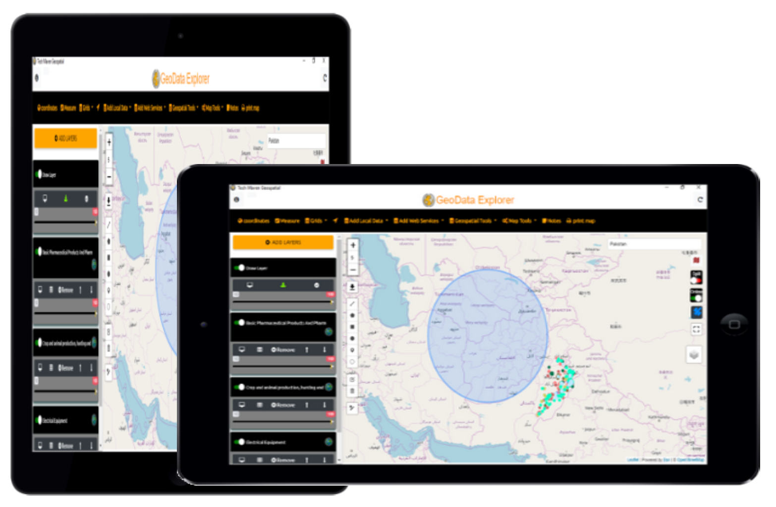
GeoData Explorer
Manual & FAQ’s
We are hard at work building a user manual. Currently we just have some feature pages and FAQ’s
Mapping Web Services

Global Area Reference System Grid
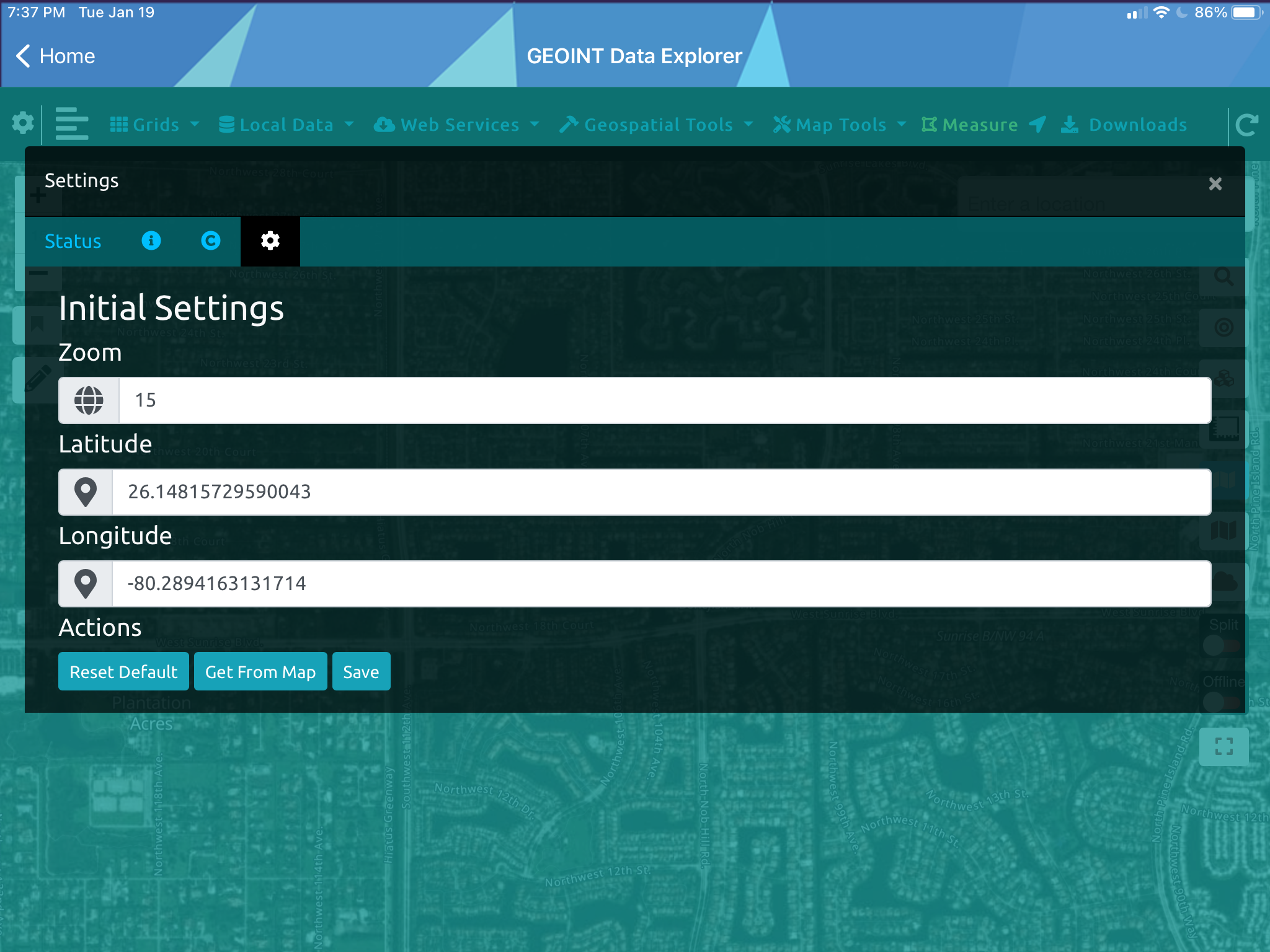
Initial map settings
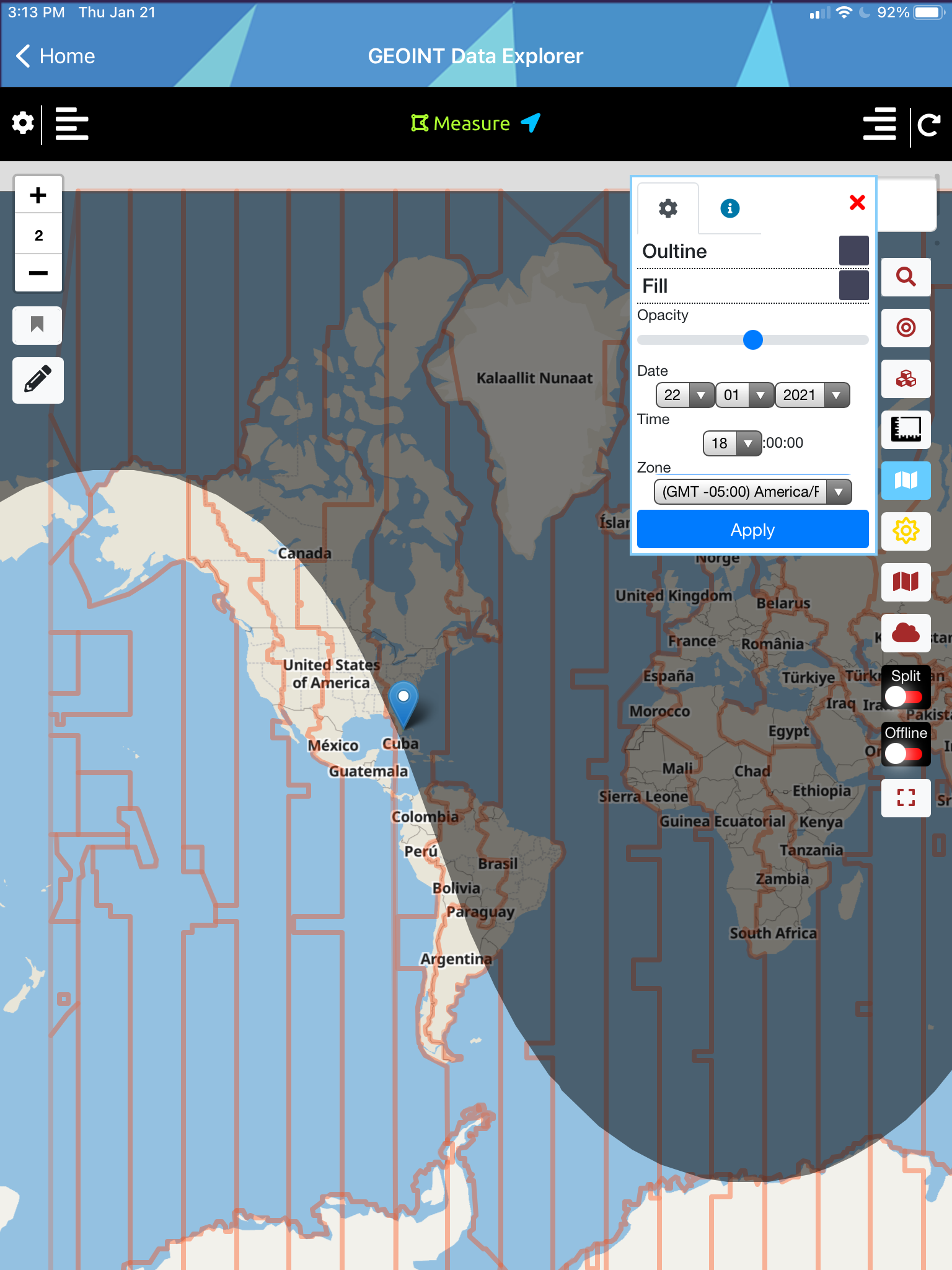
Day-Night Regions & Time Zones
OGC GPKG GeoPackage Vector Features

Place Search and Geocoding and Directions

ESRI ArcGIS ImageServices
ESRI ArcGIS Server FeatureServer Layer
Search Loaded Data
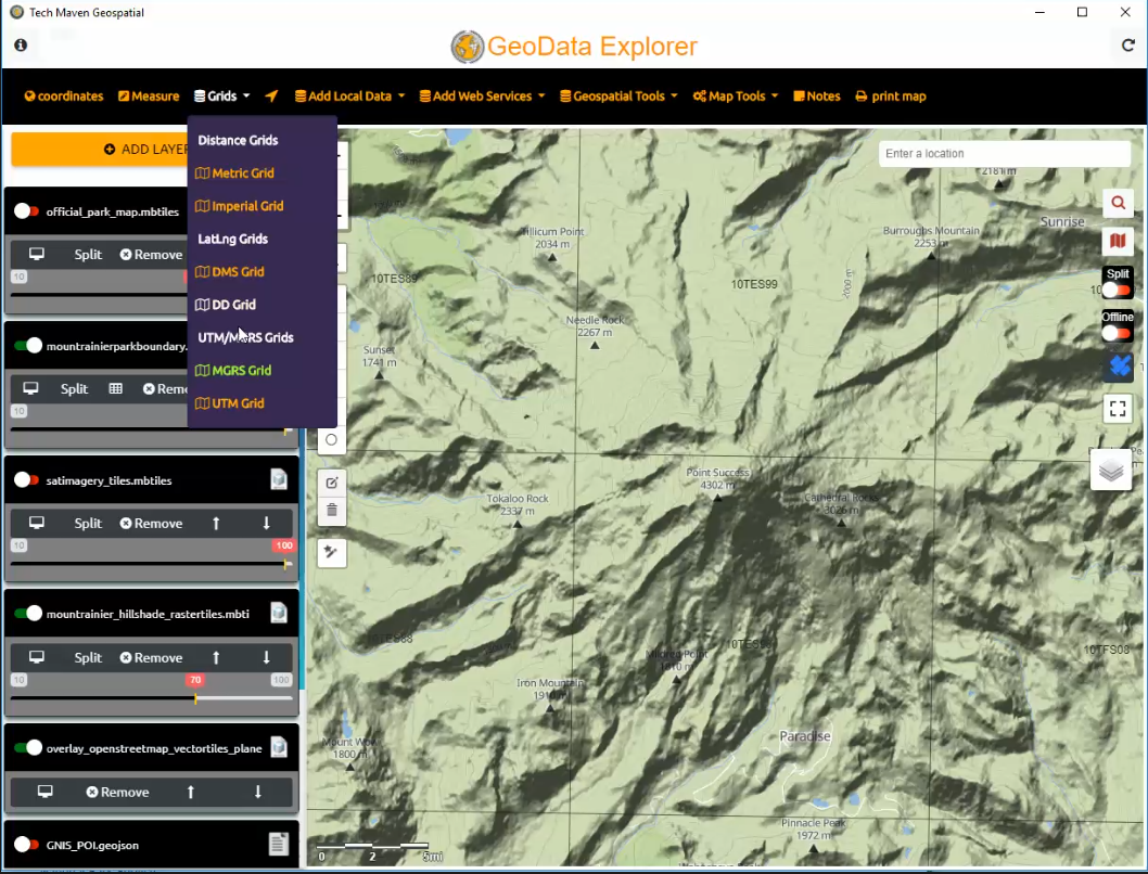
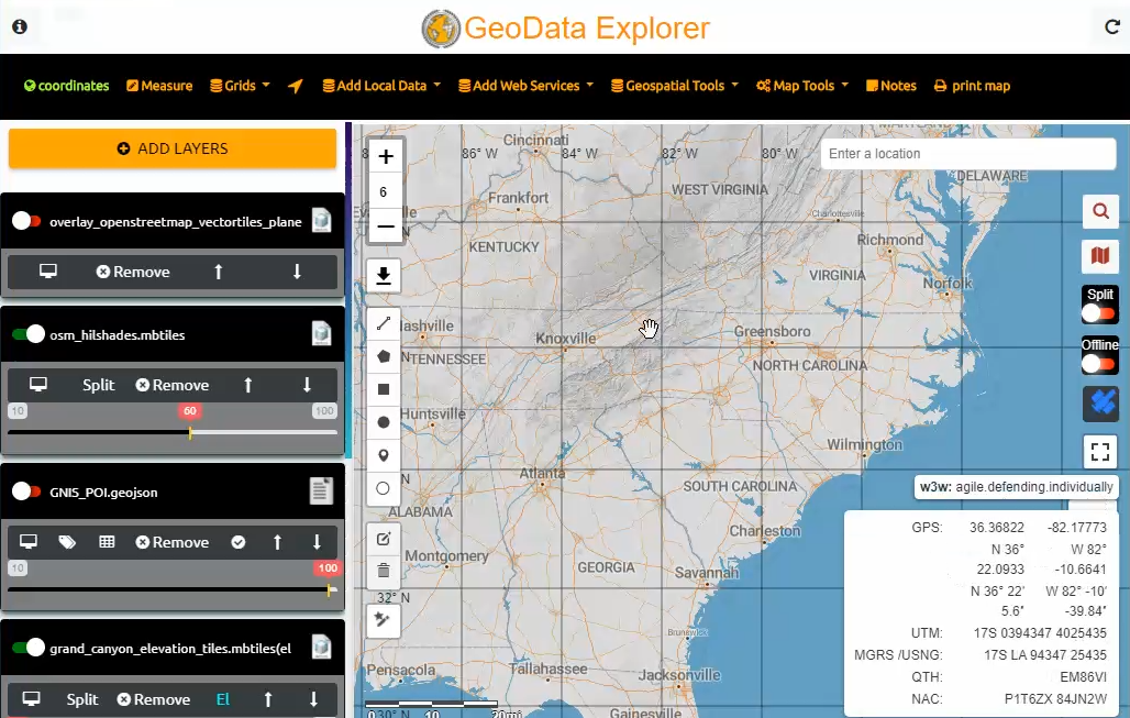
Display Grids
Style Data and Mouse Over info
Adjust Opacity

JSON Catalog
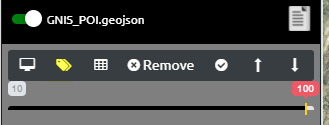
Label Features
Screen Size and Orientation
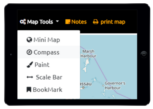

Overview MiniMap
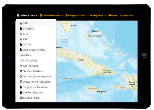
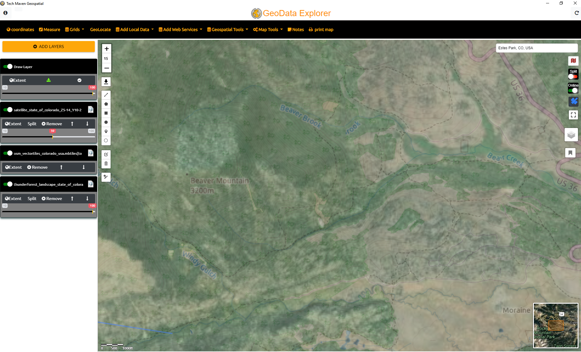
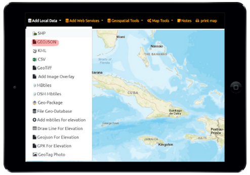
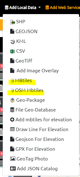
Local Data

Swipe Compare
Tiling of vector data
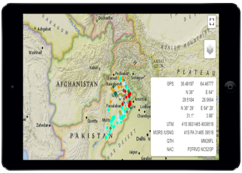
Coordinates
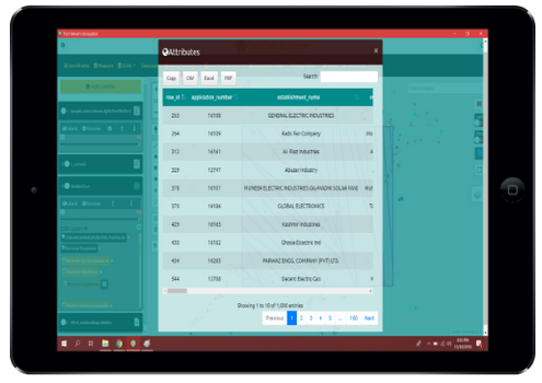
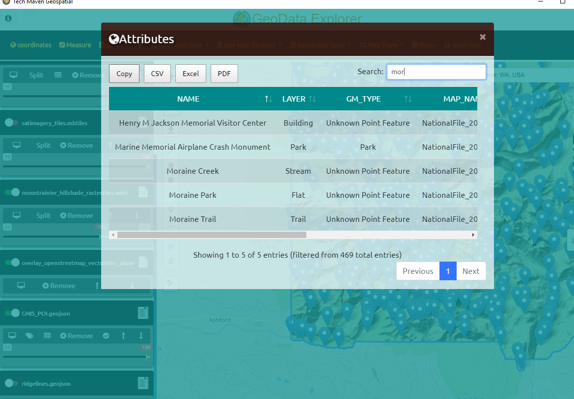
Attribute Table and Export
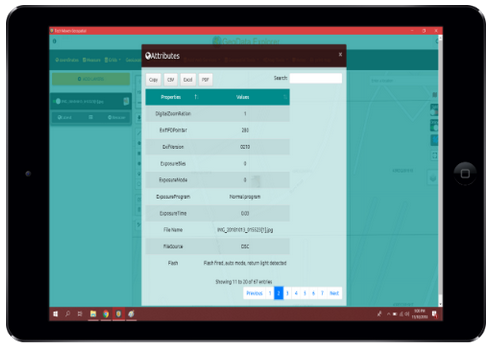
GeoTag Photos
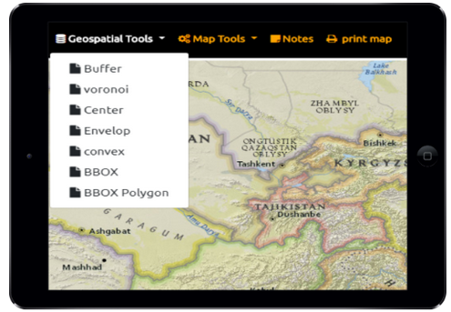
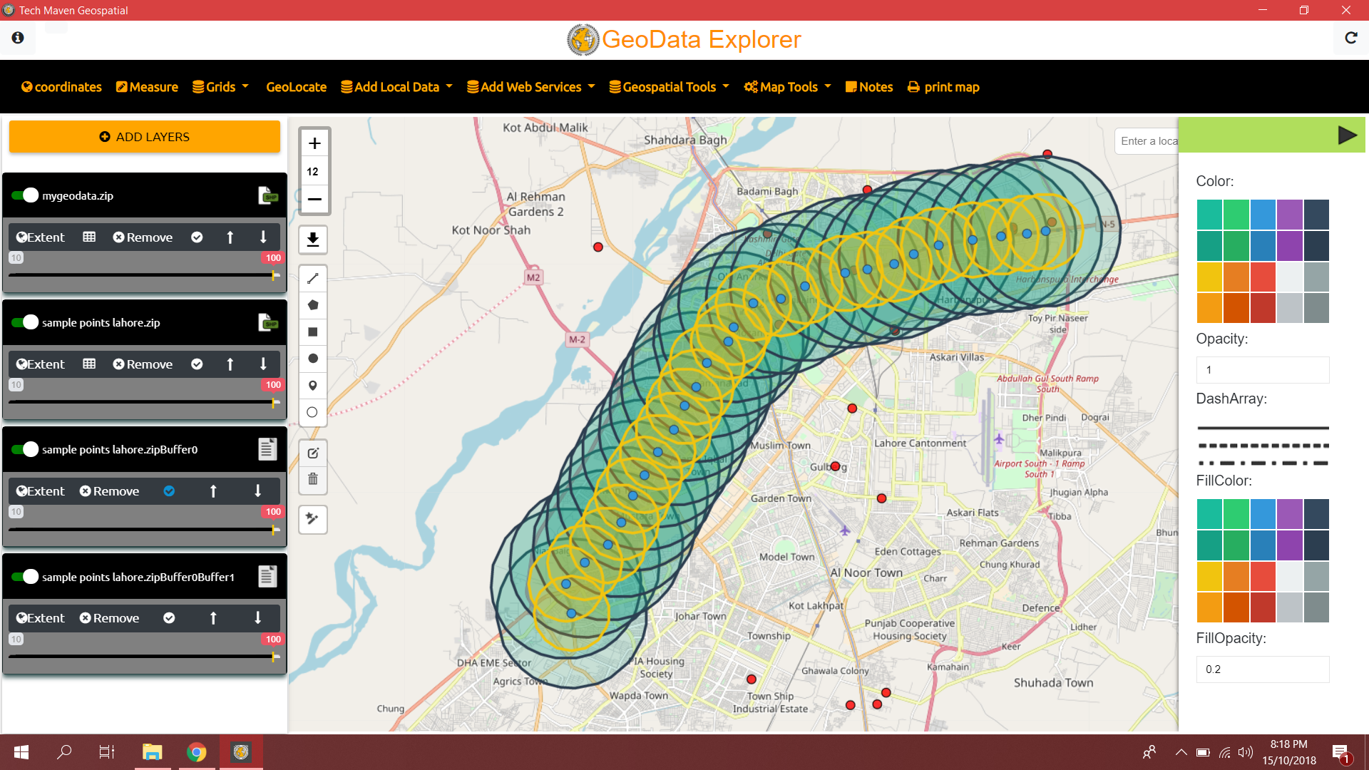
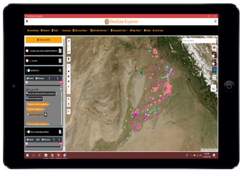
Geospatial Analysis
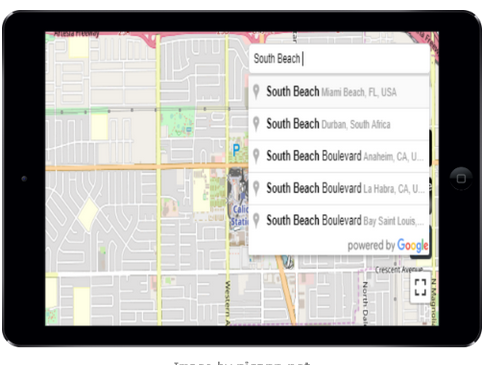
Place Search and Geocoding and Directions
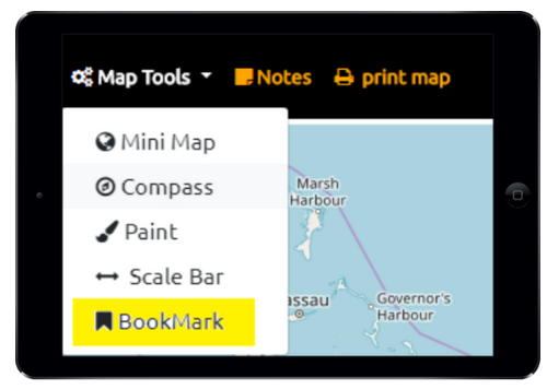
Spatial Bookmarks
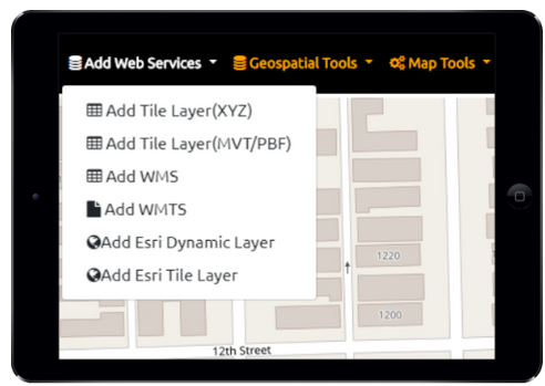
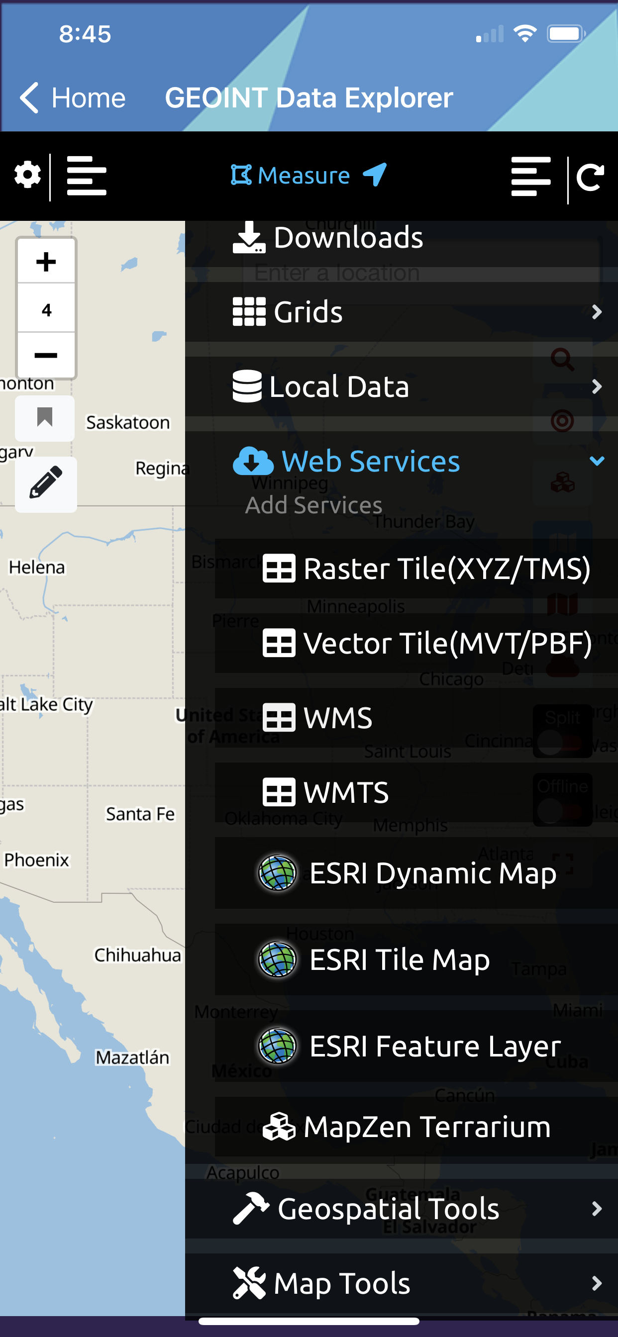
Web Services Data
Measure Tools

Basemap Picker

CSV Text File
OSM Vector Tiles

Vector Tile Server URL (.MVT/.PBF)
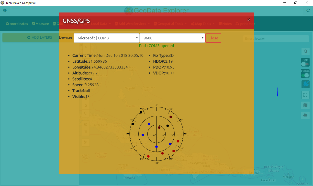
Geolocation and GNSS Settings

Raster Tile Server (XYZ or TMS)
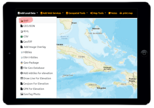
ESRI Shapefile
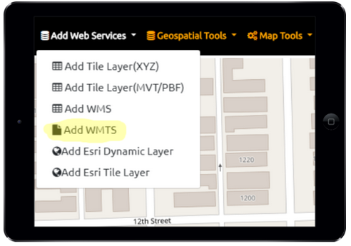
Web Map Tile Service (WMTS)
ESRI Dynamic Map Services
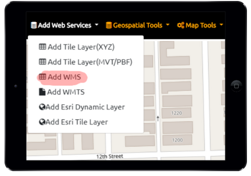
Web Map Service (WMS)

GeoPackage Features
View Offline Vector Tiles
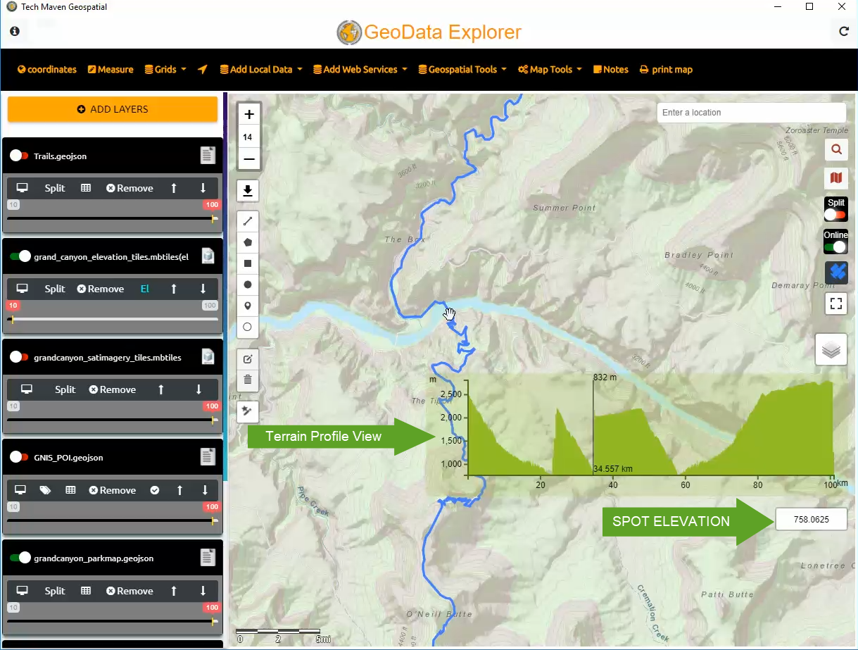
View Spot Elevation and Terrain Profile View

View Offline Raster Tiles (MBTILES/GPKG)
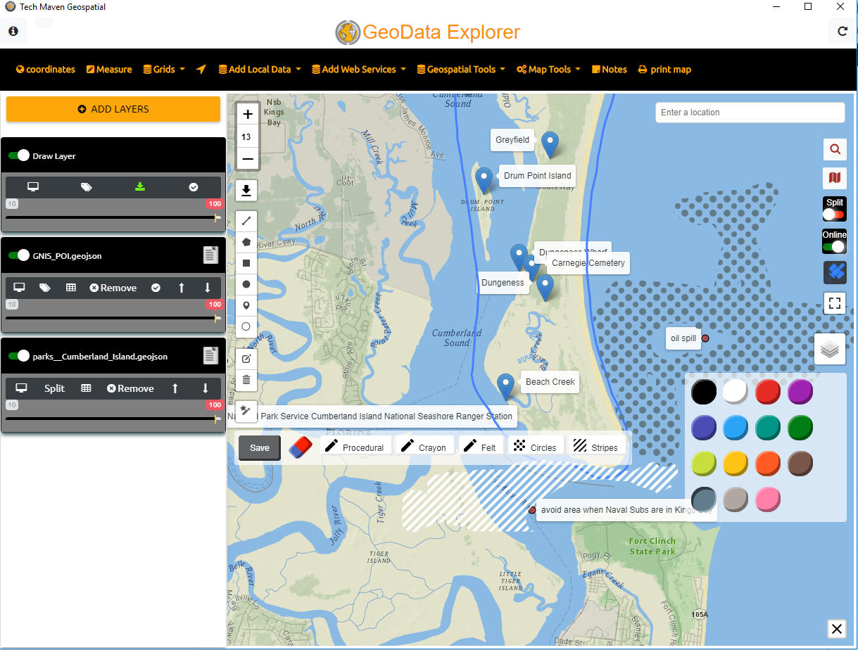
Map Annotation
Collect Feature Data
Frequently Asked Questions:
What Coordinate Reference System /Projection is supported for Vector Data?
ESRI Shapefile, FileGDB, GeoJSON and GPKG all must be in unprojected Geographic WGS84 (EPSG:4326)
GEOGCS["GCS_WGS_1984",DATUM["D_WGS_1984",SPHEROID["WGS_1984",6378137,298.257223563]],PRIMEM["Greenwich",0],UNIT["Degree",0.017453292519943295]]

Vector Tiles must be in Google Spherical Web Mercator Projection /Auxillary Web Sphere (EPSG:38567)
What Coordinate Reference System /Projection is supported for Raster Tiles?
Raster Tiles (Offline and Online) need to be in EPSG:3857 Google Spherical Web Mercator/Auxillary Web Sphere/Pseudo-Mercator. This is to keep the data consistent with other data sources and online base maps. Having to reproject tiled data causes a lot of overhead on mobile devices and tablets.
What format can I export my drawing and editing?
Currently, only GeoJSON format is supported. Click on the draw layer on the table of contents and click the downward facing arrow.
Does the app support offline spot elevation and terrain profile views?
Yes, if you’ve loaded mbtiles for elevation then as you move around the map you will see elevation readings.
The MBTILES have Terrarium Specification/Format PNG Tiles with elevation values encoded in the RGB Values of each Pixel
If you draw line for elevation, Load a GeoJSON or GPX file for Elevation you will see Graph/Chart of the Terrain Profile View along that Line/Route
Can I add Labels to my features?
Yes, click the little Label /Tag icon in the Table of Contents and then select a field to label the data.
Can I build custom forms and predefined field types?
Not at this point. We have a full feature field data collection application with rich flexible forms that can capture points, lines, and polygons called Orange Maps Collector http://collector.techmaven.net However, if you would like to create custom forms that sync to your server or database or applications we can develop that for you. https://geodataexplorerapp.techmaven.net/custom-solutions/
Can the app work with a Windows Laptop/Tablet with Internal GNSS/GPS?
Currently, NO we are actively working on adding Location Sensors as Windows calls them. You must have an external GNSS Receiver.
We support any NMEA compatible GNSS Receiver and we let you specify the COMM Port and Baud Rate.
How do I generate a GeoPackage
We recommend using QGIS Desktop a free GIS Software to convert a GeoTif Image or MrSID image or JP2 image to Raster Tiles GeoPackage or convert a shapefile or other vector data (including OGC Web Feature Service) to GeoPackage Vector Features. You can also use GDAL/OGR command line tools (gdal_translate for raster conversion and OGR2OGR for vector)
What does the number mean that's between the Zoom + -?
That’s the Zoom Level. Maps is defined by a QuadTree Pyramid of Zoom Levels. 0 being upper and 24 being most zoomed in and detailed.
How to generate Vector Tiles
vector tiles can be generated from many tools.
GDAL OGR2OGR https://www.gdal.org/drv_mvt.html -f MVT – we recommend installing OSGEO4W suite of tools and software
MapBox Tippecanoe (linux command line tool run in WSL Bash for Windows Ubuntu)
MapBox Studio Classic
Python Script
We don’t support ESRI VTPK however there are probably tools to convert them into mbtiles.
Tech Maven Geospatial will be selling a desktop Vector Tiling Tool in 2019
How do I build the JSON that the there is to import?
We have a simply JSON builder for adding MapServices URL’s
Please see: GeoDataExplorer_Services_Creator-Editor