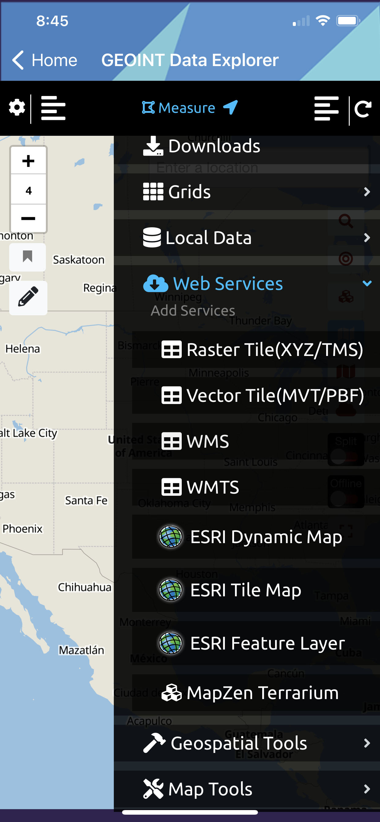
Web Mapping Services
(Internet Required to connect to these services)
The app supports users loading OGC and ESRI Mapping Services to the map (introduced as 1.1 feature and will be expanded in upcoming releases with additional capabilities)
| Service | Example |
| Raster Tiles (XYZ/TMS) Tile Server | |
| Vector Tiles (MVT/PBF) Tile Server | |
| OGC WMS – Web Map Service | |
| OGC WMTS – Web Map Tile Service | |
| OGC WFS – Web Feature Service – Coming soon | |
| ESRI Dynamic MapServer/MapImage Service | |
| ESRI Tile Map (Cached) MapServer/MapImage Service | |
| ESRI Feature Server (FeatureServer) | |
| MapZen Terrarium 24bit PNG Elevation Tiles (this data is for SPOT Elevation and Terrain Profile View) | |
| Other’s Planned | |
| OGC WCS – Web Coverage Service | |
| ESRI ImageServer | |
| ESRI LERC Elevation Tiles | |
| OGC SOS | |
| OGC Moving Features | |
| OGC API Features | |
| OGC API Tiles | |
| STAC | |
| Open Data Protocols (CKAN, CSW, SOCRATA, SDMX) |