
We are a full service Geospatial Information Technology Services firm
Data Services and custom features and functionalityTech Maven Geospatial builds custom solutions tailored to your organization’s specific needs.
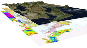
Consulting and data development services
Do you have Orthophoto-Aerials that you want to load into the app, no problem we can offer map tiling services that deliver highly optimized map tiles ready for ingestion into the app as GeoPackage or MBTILES or serving over the web as XYZ/WMTS Tile Layers.
Do you have data formats that are not supported by the app? (MapInfo Tab, Spatialite, DXF/DWG/DGN, Personal Geodatabases, and Other formats) Or data that’s not optimized for the app, Not a problem we offer data conversion and translation services and can generate mbtiles vector tiles and OGC GeoPackage features. We also perform address geocoding services and working with non-spatial attribute data and mapping it.
We can also assist you in integrating in your enterprise spatial databases and services into the app.
Data Development Services
Custom Development Services
Please feel free to send email to developer at techmaven.net to get the conversation going
You may also call us 754-333-1650
Tech Maven Geospatial is a fully capable and application development firm that specializes in geospatial mapping we would love to support your specific use cases and needs for special features and custom applications. We would gladly build you a special version of GeoData Explorer or Orange Maps Collector or custom new application.