Map Features
Adjust Opacity
Attribute Table and Export
Collect Feature Data
Coordinates
Display Grids
Geolocation and GNSS Settings
Geospatial Analysis
GeoTag Photos
Label Features
Map Annotation
Overview MiniMap
Place Search and Geocoding and Directions
Screen Size and Orientation
Search Loaded Data
Spatial Bookmarks
Style Data and Mouse Over info
Swipe Compare
Tiling of vector data
View Spot Elevation and Terrain Profile View
Tools
Map Tools
Measure Tools
Global Area Reference System Grid
Day-Night Regions & Time Zones
Local Offline Data
GeoJSON
ESRI Shapefile
OGC GPKG GeoPackage Vector Features
GeoPackage Features
Local Data
OSM Vector Tiles
View Offline Raster Tiles (MBTILES/GPKG)
CSV Text File
View Offline Vector Tiles
Initial map settings
Map Data Store
Internet Connected Data
Basemap Picker
Mapping Web Services
Web Services Data
JSON Catalog
ESRI Dynamic Map Services
ESRI ArcGIS Server FeatureServer Layer
ESRI ArcGIS ImageServices
Web Map Service (WMS)
Web Map Tile Service (WMTS)
Raster Tile Server (XYZ or TMS)
Weather
Vector Tile Server URL (.MVT/.PBF)
GeoDataExplorer
GEOINT Data Explorer
GEOINT DATA EXPLORER home page
Military Symbology
GRG-Grid Reference Graphic
Day Night Terminator and Timezones
Manual
About Data
Feedback
Home
Manual
Data-Attribution
privacy policies
Release-Notes
Notes about Map Data
Industries
Feedback
Customize
|
Blog
Contact
Support
Select Page
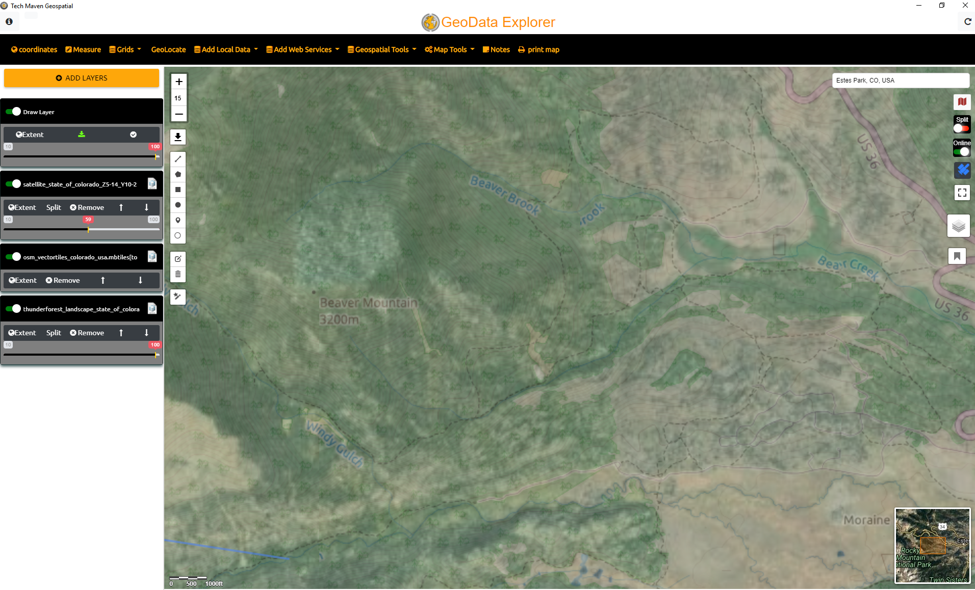
Adjust Opacity
Adjust Transparency/Opacity per layer
Search for:
Map Features
Adjust Opacity
Attribute Table and Export
Collect Feature Data
Coordinates
Display Grids
Geolocation and GNSS Settings
Geospatial Analysis
GeoTag Photos
Label Features
Map Annotation
Overview MiniMap
Place Search and Geocoding and Directions
Screen Size and Orientation
Search Loaded Data
Spatial Bookmarks
Style Data and Mouse Over info
Swipe Compare
Tiling of vector data
View Spot Elevation and Terrain Profile View
Tools
Map Tools
Measure Tools
Global Area Reference System Grid
Day-Night Regions & Time Zones
Local Offline Data
GeoJSON
ESRI Shapefile
OGC GPKG GeoPackage Vector Features
GeoPackage Features
Local Data
OSM Vector Tiles
View Offline Raster Tiles (MBTILES/GPKG)
CSV Text File
View Offline Vector Tiles
Initial map settings
Map Data Store
Internet Connected Data
Basemap Picker
Mapping Web Services
Web Services Data
JSON Catalog
ESRI Dynamic Map Services
ESRI ArcGIS Server FeatureServer Layer
ESRI ArcGIS ImageServices
Web Map Service (WMS)
Web Map Tile Service (WMTS)
Raster Tile Server (XYZ or TMS)
Weather
Vector Tile Server URL (.MVT/.PBF)
GeoDataExplorer
GEOINT Data Explorer
GEOINT DATA EXPLORER home page
Military Symbology
GRG-Grid Reference Graphic
Day Night Terminator and Timezones
Manual
About Data
Feedback
Pages
Agriculture
Architecture, Engineering, Construction and Planning
Asset Management
Asset Management
Custom solutions and data for GeoData Explorer
Data-Attribution
Defense and Intelligence
Demo Geo Data Explorer
Emergency Management
Feedback and Suggest Features
GEOINT_DATA_EXPLORER
Home
Hometest
IGAPP GEOINT DATA EXPLORER Feedback and Suggest Features
Industries
Insurance and Damage Assessment
Land Survey and Mapping
Law Enforcement
Manual
Natural Resources Conservation and Environment
NGO and Humanitarian
Notes about Map Data
Pricing
privacy policies
RealEstate and Property Management
Release-Notes
test
Utilities
Translate »